Training Drone Detection Models to Distinguish Birds From Drones
Umbrella Aerospace combines diverse synthetic environments, object tracking, and informed decision-making to help distinguish drones from birds and other airborne objects.

Summary
Recent research highlights the challenges of distinguishing birds from drones, particularly at greater distances and under difficult visual conditions. Umbrella Aerospace addresses these challenges through Visual Simulation, generating diverse synthetic datasets across environments, weather, and lighting conditions. Combined with object tracking over time, this approach helps perception models distinguish legitimate drone targets from non-target activity, while strategy and control software supports further investigation when classification remains uncertain.
For a vision-based drone detector, finding an object against an open sky can be relatively straightforward. The more difficult problem begins when the object is small, distant, moving, partially obscured, or visually similar to something else that routinely occupies the same airspace.
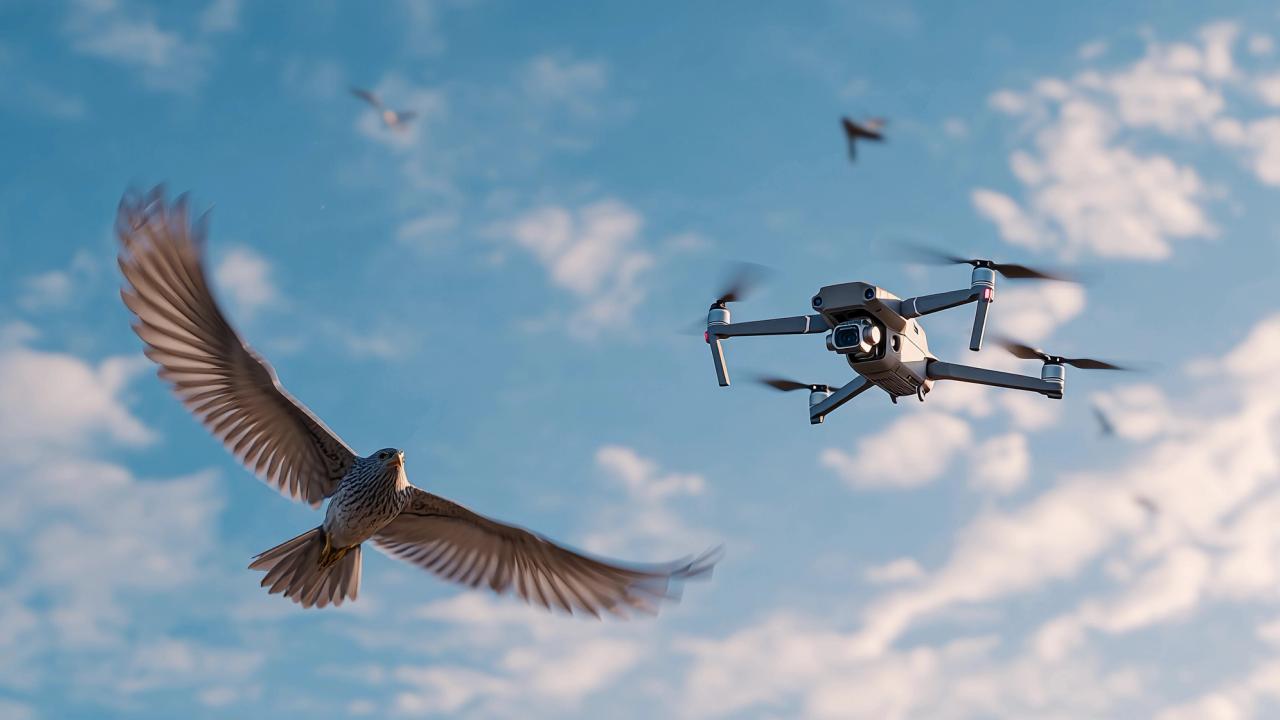
Birds are one of the clearest examples. At close range, the distinction between a quadcopter and a bird can appear obvious. At longer distances, much of that information disappears. Both may occupy only a small number of pixels. Wings, rotors, payloads, and other structural features can become difficult to resolve. Motion blur can alter apparent shape, while lighting, haze, cloud cover, vegetation, and complex terrain further reduce usable visual information.
The resulting perception problem is not simply drone detection. It is airborne-object discrimination.
Recent research and datasets published in 2026 are making that distinction increasingly visible. They also illustrate a broader principle for synthetic-data engineering: robust perception depends not only on representing the object a model should detect, but on deliberately representing the objects it should reject.
How Umbrella Aerospace Approaches Airborne-Object Identification
Umbrella Aerospace (opens in a new tab) approaches airborne-object identification as a combination of diverse perception training, observation over time, and informed decision-making. Rather than relying solely on an object's appearance in a single image, the objective is to develop systems capable of distinguishing legitimate drone targets from birds, environmental interference, and other non-target activity.
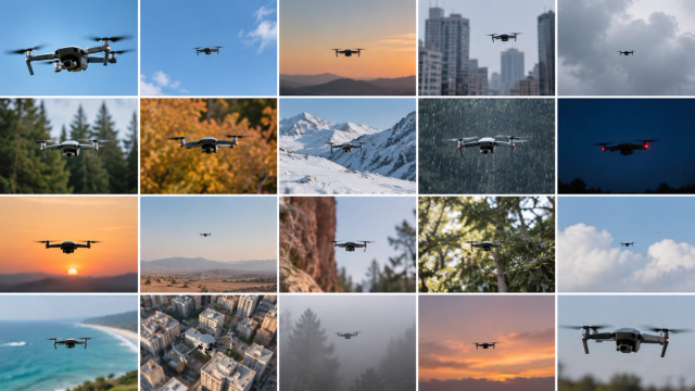
The process begins with synthetic training data. Through visual simulation (opens in a new tab), datasets can represent a wide range of operating environments, including forests, cities, mountains, and deserts. Environmental effects such as snow, blowing leaves, dust clouds, changing illumination, and reduced visibility introduce additional complexity. By varying these conditions systematically, synthetic datasets expose perception models to challenging combinations of backgrounds, objects, and visual interference that may be difficult to collect consistently in the physical world.
Identification also benefits from observing how an object behaves over time. Humans often distinguish distant birds from man-made aircraft by watching their movement patterns rather than relying on appearance alone. Similarly, tracking an airborne object across successive observations provides additional information about its motion and behavior. These patterns are not definitive, but they can help distinguish likely drone detections from non-target activity and identify objects that remain uncertain.
That uncertainty is where perception connects to strategy and control. An object may be classified as a likely drone, dismissed as non-target activity, or flagged as suspicious when the available evidence is insufficient. Rather than treating every ambiguous detection as a confirmed threat, the system can prioritize continued observation, maintain focus on the object, or seek a closer view or additional sensor information. Strategy and control software can then determine the appropriate next step based on the available evidence and operating context.
This approach recognizes that reliable airborne-object identification is not always a single-frame classification problem. It is a process of improving the quality of training data, interpreting observations over time, and managing uncertainty before making operational decisions.
Small Objects Lose the Features That Make Them Distinct
Object scale fundamentally changes the information available to a computer-vision model. Research published this year in Remote Sensing in Ecology and Conservation provides an unusually detailed view of this relationship. The Big Bird project assembled (opens in a new tab) 23,865 drone images captured with 21 cameras across 11 countries and all seven continents. Researchers labeled 4,824 images containing 49,990 birds from 101 species and analyzed the factors influencing detection and classification performance.
One significant predictor was the number of pixels occupied by the bird. Performance also increased when test imagery came from locations represented in the training data and decreased as the number of classes with similar size and plumage increased.
Although the study focuses on ecological surveys rather than drone detection, those findings are directly relevant to airborne perception. As an object becomes smaller, classification increasingly depends on limited visual evidence. At the same time, environmental familiarity matters. A model that performs well against backgrounds represented heavily in training may not perform equally well when geography, vegetation, illumination, camera characteristics, or other environmental variables change.
The problem becomes harder still when two classes are visually similar.
Birds Should Be Treated as a Training Class, Not Background Noise
A drone-detection dataset could contain thousands of accurately labeled drones and still produce an operationally weak model if the surrounding airborne environment is poorly represented.
That is because classification requires contrast. A model does not learn only what belongs to a class. It also learns boundaries between classes. For drone detection, birds help define one of those boundaries.
The 2026 BirDrone research addresses this problem explicitly. Its dataset contains drones and birds captured at different altitudes, orientations, distances, and positions, with difficult examples involving small and low-contrast objects, partial occlusion, motion blur, and complex backgrounds. The associated YOLOBirDrone architecture (opens in a new tab) was designed specifically to preserve and extract useful features from visually ambiguous airborne targets.
A separate peer-reviewed study published in July (opens in a new tab) evaluated low-altitude UAV-versus-bird recognition across multiple datasets and detection architectures. Its results show that performance varies meaningfully between datasets, reinforcing the difficulty of assuming that success in one airborne visual distribution will transfer cleanly to another.
The dataset lesson is important: negative examples cannot simply be random images without drones. They need to include plausible sources of confusion.
The Airspace Contains More Than Two Classes
Even bird-versus-drone classification simplifies the real environment. A new Multi-Background Airborne Object Detection dataset (opens in a new tab) published August 18 includes six airborne classes: airplanes, birds, helicopters, kites, parachutes, and UAVs. Its images span sky, forest, desert, mountain, lake, field, urban, and semi-urban backgrounds and include different object scales, orientations, and positions, as well as background-only and multi-object scenes.
That structure reflects the actual classification problem more accurately. A visual perception system may encounter multiple airborne objects that share some attributes with its target class.
For dataset engineers, this suggests that distractor design should consider several dimensions:
- Visual similarity: birds, aircraft, kites, balloons, or other objects whose silhouette can resemble a small UAV at distance.
- Scale: objects should appear across pixel sizes representative of expected detection ranges, including extremely small instances.
- Background: sky-only imagery is insufficient if deployment includes trees, buildings, mountains, water, clouds, or terrain behind the object.
- Image degradation: blur, low contrast, compression, haze, sensor noise, and partial occlusion can remove distinguishing features.
- Geometry and motion: orientation, approach angle, banking, flapping, hovering, and changing aspect can alter the apparent shape of both drones and biological objects.
- Empty scenes: background-only examples help teach the model that the absence of a target is itself a valid classification state.
This is where synthetic generation becomes particularly useful.
Synthetic Data Can Engineer the Confusion
Physical collection can capture birds, drones, and other airborne objects, but it does not guarantee balanced coverage of the combinations most likely to confuse a model.
A simulation environment can deliberately create them. SimD3 (opens in a new tab), a synthetic drone dataset introduced in January 2026, takes this approach by incorporating multiple bird species as explicit distractors alongside drones with heterogeneous payloads. The dataset uses controlled weather, lighting, flight trajectories, and diverse virtual environments, and the researchers evaluated models using synthetic data, mixed synthetic-real data, and unseen real-world benchmarks.
The important concept is not simply adding birds to synthetic scenes. It is controlling how they become difficult. A dataset could systematically vary target and distractor scale while holding background constant. It could compare birds and drones at similar apparent sizes, reproduce difficult viewing angles, change illumination, introduce motion blur, or position objects against increasingly complex backgrounds. Model evaluation could then identify which combinations produce confusion, and those combinations could be emphasized during subsequent generation.
This turns a false positive into a dataset specification. If birds are frequently classified as drones at a particular scale and viewing angle, the next training set can contain more examples around that boundary. If errors increase against vegetation or clouds, those backgrounds can be overrepresented. If a particular bird silhouette consistently creates confusion, similar biological shapes can be introduced deliberately. The dataset becomes responsive to the model's mistakes.
Diversity Must Include the Distractor
The Big Bird research provides another useful insight. Its 101 bird species span considerable biological diversity, yet classification became more difficult as the number of classes with similar size and plumage increased.
For drone-detection training, a generic "bird" class may therefore conceal substantial visual variation. Different species produce different silhouettes. Wing position changes continuously during flight. Birds can glide, flap, bank, descend, hover briefly in wind, appear alone, or travel in groups. Distance and image resolution can collapse those differences into ambiguous shapes.
Synthetic data offers the ability to vary those characteristics systematically, but only if distractor diversity is treated as an intentional component of dataset architecture.
The same principle applies beyond birds. A robust airborne perception dataset should not ask only, How many drone examples do we have? It should also ask, How thoroughly have we represented the things a drone could be mistaken for?
Conclusion
Bird-versus-drone discrimination exposes a larger truth about perception training: the hardest examples are often found at the boundaries between classes.
Adding more clean drone imagery may improve recognition of drones the model already understands. It does not necessarily teach the model how to respond when the visual evidence becomes ambiguous.
Recent datasets (opens in a new tab) are moving toward a more useful approach. They include small targets, multiple environments, difficult backgrounds, diverse airborne classes, biological distractors, and explicit tests of generalization beyond the original training distribution.
Umbrella Aerospace’s Visual Simulation approach can extend that capability by making ambiguity configurable. Instead of waiting for a bird and drone to appear at the same apparent scale, under the right illumination, against the right background, with the right amount of blur, those conditions can be generated deliberately and repeated systematically.
Yet reliable identification extends beyond training data and individual images. Observing an object's movement over time provides additional evidence that can help distinguish likely drones from birds and other non-target activity. When classification remains uncertain, strategy and control software can support continued tracking, closer observation, and further evaluation rather than treating an ambiguous detection as a confirmed threat.
Identifying an airborne object is only part of the challenge. Determining whether that object requires intervention introduces a separate operational decision, one explored in our article on why the next challenge in drone defense is not detection (opens in a new tab).
That changes the purpose of synthetic data. It is not simply a way to create more positive examples, but a way to deliberately shape the decision boundaries a perception model must learn. Combined with temporal observation and informed decision-making, this approach supports more reliable airborne-object identification and a more measured response to uncertainty in the physical world.

Yuriy KoshkinFounder & President
Yuriy Koshkin writes about autonomous systems, drone security infrastructure, and evolving aerial risk environments. He is a technology leader and entrepreneur focused on advancing autonomous systems and developing practical approaches to emerging security challenges.